compiled by Kevin McCue
26 km E of Nurdağı, Turkey
2023-02-06 01:17:35 (UTC)
A major shallow earthquake struck southeast Turkey during the night causing destruction of buildings and loss of human life. The epicentre was near the Syrian border but damage extended to Beirut nearly 500 km away and the shaking was felt as far as Istanbul, 800km away.
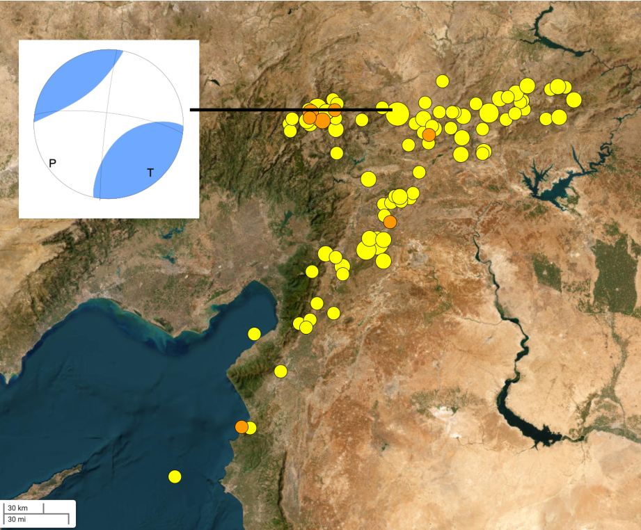
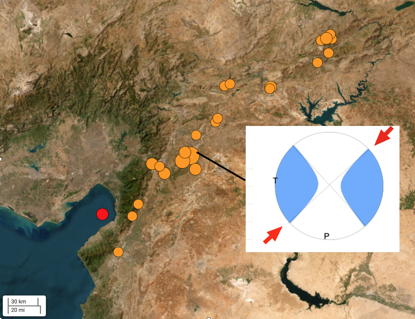
The earthquake was shallow so there is no doubt surface faulting will be found extending for perhaps the whole 300km indicated by the immediate aftershocks (Figure 2) .
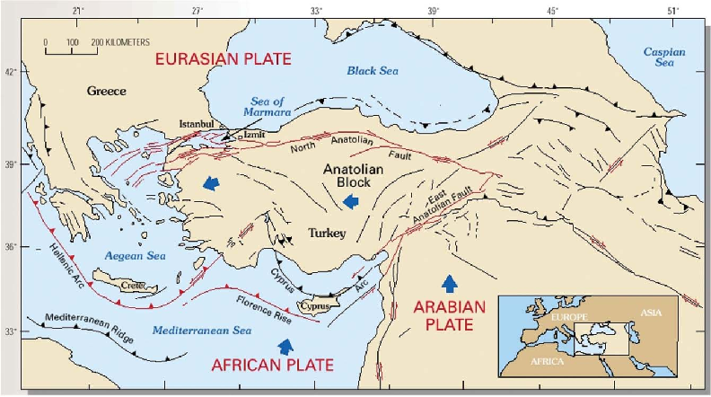
The Anatolian Block (small plate) is being squeezed between the Eurasian Plate in the North and the Arabian and African Plates in the South. Its northern border is the Anatolian Fault, a much studied structural feature. Its eastern boundary is not as well studied.
History
Ambraseys (1989) wrote about the East Anatolian Fault Zone:
The Border Zone that is the contact of the Arabian plate with the three plates of Turkey, Eurasia and Iran to the north has been remarkably aseismic during this century. By extending the period of observation backwards in time by a few centuries it is shown that this seismicity is atypical of the long-term behaviour of the zone and due to a quiescent period in the activity of the area during the 20th Century. In turn, this implies that short-term data alone do not provide a reliable assessment of earthquake hazard.
He goes on to say that:
The East Anatolian Fault is clearly sinistral ….. and the deformations associated with earthquakes in this zone seem to occur along the entire length every few hundred years during relatively short paroxysmal periods of large events…….. the first paroxysm in our period of observations ended in 1544 and the second started after two and a half centuries of relative quiescence in 1789……. between 1789 and 1905, a series of relatively large earthquakes began, alternating between the two ends and gradually converging to the middle of the East Anatolian Fault zone…..Almost all of the few cases that allude to faulting, i.e. in 1822, 1872, 1874 and 1905, are for events in this 100km wide zone that shows remarkably low background seismicity, not only during this century but also in earlier times.
Damage
Earthquakes don’t kill people, they die under collapsed buildings or in secondary effects like tsunami and landslides. Turkey has a modern PSHA based hazard map and a modern building code. So why did so many buildings collapse so catastrophically? According to James Daniell recorded PGA reached 0.88g along the rupture zone between Malatya and the sea (Figure 2). The ductility demand far exceeded the design ground shaking so there was bound to be damage but surely we know enough now that collapse can be prevented if buildings are designed and constructed appropriately using simple techniques such as base-isolation.
Some of the collapsed multi-story buildings seen on TV had little reinforcement and very slender columns. The concrete was light, rescuers threw blocks around as though it was balsa. Large aftershocks caused further collapse and damage. No doubt a formal report will be produced in coming weeks as to the quality of buildings and materials. The main thing to learn is to not rebuild them in this same fashion, with little regard for future earthquakes, but it is cold and many
hundreds of thousands of people are without shelter.
BBC – Turkey earthquake: Why did so many buildings collapse?
Australian Government Response
Surprisingly the Australian Government is sending a 72 person Search and Rescue team to SE Turkey, consisting of trained military and police. Apparently they are self sufficient with their own tents, food and equipment. Surprisingly because they sent no personnel to Papua New Guinea, our nearest neighbour, following a destructive M7.5 earthquake there in 2018 yet they are travelling half way around the world to assist in this disaster. By the time they get there the rescue phase will be well and truly over.
References
Ambraseys, N.N., 1989 Temporary seismic quiescence: SE Turkey. Geophysical Journal (1989) 96, 311-331.
Daniell J. 2023. email to the AEES list server 8 Feb 2023.
Gökkaya, Kemal. (2016). Geographic analysis of earthquake damage in Turkey between 1900 and Geomatics, Natural Hazards and Risk. 7. 10.1080/19475705.2016.1171259.