2023-08-05 2134 Gnowangerup Ml 5.7, Mw 5.0 (GA)
David Love (updated 14 Aug)
Location
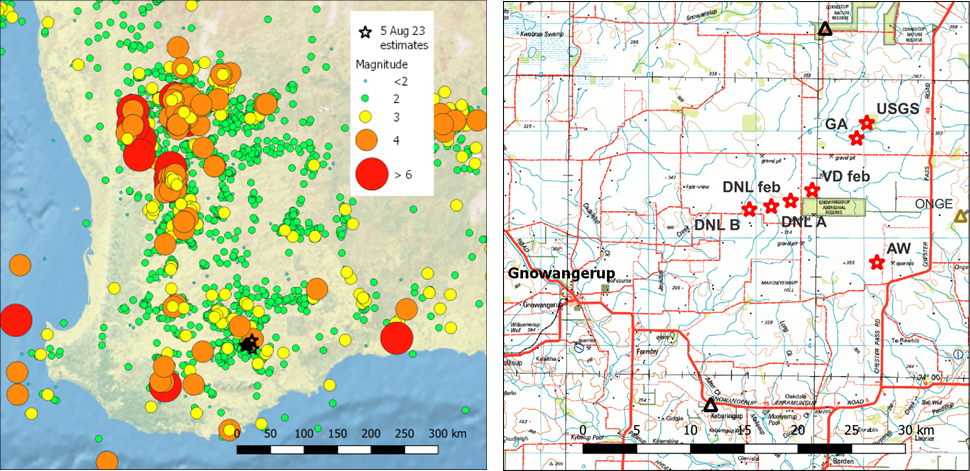
The event is in the far south of the SWSZ. RHS figure shows various estimates of the main shock location (USGS, Geoscience Australia, A Wallace, DN Love A, and B with PSN seismographs, also 2 estimates of a small event 27 Feb 2023.) A mag 4.5 event occurred on 5 Jan 2023 in the same general location. Vic Dent had marked this as a possible cluster point as early as 2020, but this has not been in any of his published work.
Full details of DNL and AW locations can be seen at https://earthquakes.mappage.net.au/q.php
Ruth Murdie says the SWAN network (ANU,GSWA) is still out and data will be collected in November. Nearest 2 stations are shown as black triangles in RHS figure above. These will help significantly with location and attenuation, but not depth, unless it is greater than 10 km.
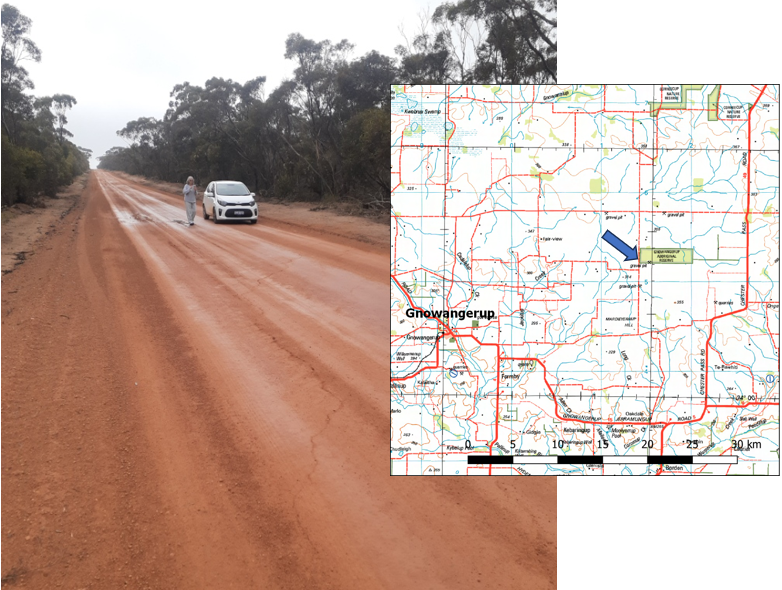
Vic Dent has installed a PSN seismograph at Gnowangerup on 11th, and sent a photo of a small crack in the road in epicentral area.
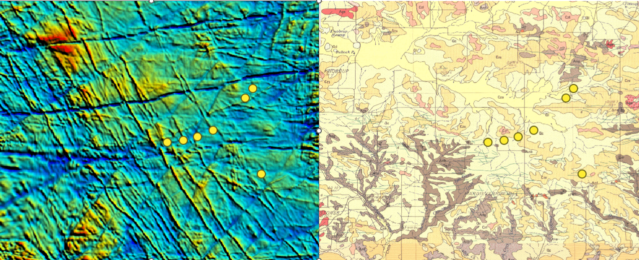
Surface geology and magnetics
Surface geology (from DMIRS GeoWIEW.WA) shows no major features or faults. Many dolerite dykes. Magnetic image shows dykes, with some fault offsets. How well do these lineations match the focal mechanisms? Circles are same points as in previous map.
Aftershocks
Vic Dent has identified 5 aftershocks (to 11th) from his Dumbleyung seismograph.

The longer S-P for mainshock typically occurs because an early P is easy to recognise, but the S matching that P is barely visible. These aftershocks are all very small, the largest being about 4 magnitude units smaller than the mainshock.
Depth
Kevin McCue says that the Rg phases are not impressive, suggesting it might be deeper than 5km.
The extremely limited aftershock activity (for SWSZ at least) also suggests the possibility that it is not shallow, which I would consider to be a bit unusual for the SWSZ.
The nearest currently available stations are over 50km away, therefore a depth cannot be estimated from a standard location computation. For the Jan and Feb events the ONGER station was running (see ONGE in figure above), but this was still 15km away, so it is still hard to tie down a depth.
USGS used 10 km, GA used 5km, and my locations used 5.
InSAR will be available this week?
Focal Mechanism
The USGS and GA moment tensor mechanisms are somewhat different, although one of the planes on each have similar strikes. USGS is on left, and GA on right. I will attempt a first motion mechanism, however first motions are highly emergent in most cases, and from past experience it is unlikely to be useful.